Rowdy Dawg
Rowdy Dawg Mountain Bike Race
October 15, 2006
Start Time : 11:00
9:00 am for XXC
$20
$10 for Beg 1
Special Thanks to Sponsors:
Oury Grip
Hammer Nutrition
EastCoasters
Bicycling Magazine
Trek Bicycles
Sole Footbeds
******NEWS****
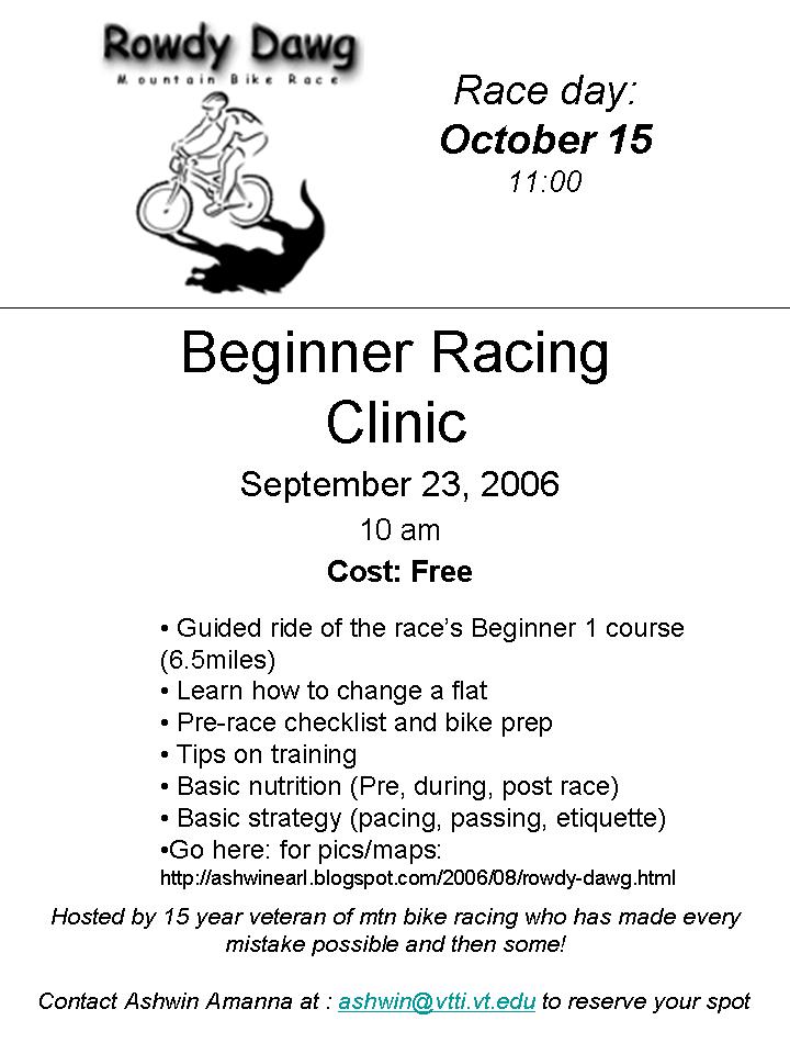
I will be hosting a beginner racer clinic on September 23rd at the race course. Probably starting at 9am.
-Well go over fixing flats, chains
-basic bike prep b4 a race
-basic nutrition for pre event and during the race
-some basic tips on pacing / passing and strategy (survive!)
-And we'll ride the whole Beginner 1 course. Beginner 2s are welcome to join for the first part as it's on their course
email me directly at
ashwin@vtti.vt.edu if you are interested and I'll send more information.
Cost is FREE, pay me back by coming out and racing.
See HERE for a flyer
*********************
Intro
Rowdy Dawg is one of the longest running mountain bike races in Virginia. The tradition continues on October 15th, 2006 on Brush Mountain in Blacksburg. This year's event will be very grassroots without a lot of hoopla. Just hanging out and racing hard. There will be water stations along the course but there will be no food served after the race so come prepared.
The Brush Mountain Breakdown is a trail running race that will be held the day before on Saturday. If you're a zealot for punishment you can do both. Man that would be something, I'm so unbalanced due to specialization to cycling that I can barely walk to the fridge.
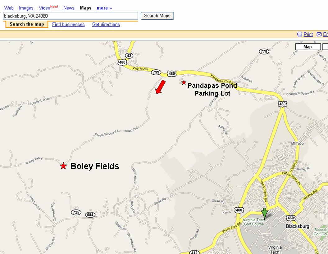
Location
The staging area will be at the the Broce's Field which is located off Forest Service Road 708 in the Jefferson National Forrest just down a little from Boley Fields campground.
Directions: Coming from West Virginia: Turn right onto Forrest service Road 708 (located at the top of Gap Mountain)
Coming from Blacksburg, VA: Turn left onto FS Road 708. This is the next road after the Pandapas Pond Recreation Area and Craig Creek Road (Rt 621)
This is a gravel fire road that will take you to the staging area.
708 also comes out the other end at Lick Run road should you prefer to take surface roads. For reference the closest primary road is Prices Fork Road.
Course Descriptions
Use this info for background reference only. It's sort of a mish mash of last year's course and what we've discussed this year's course as doing. Rely on the information you get at registration and the pre-race meeting for the your official course:
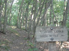
Experts will do the following: Poverty Creek to, Gap trails, down royale, up horse nettle, to Brush Mtn Ridge Road down snake root, Poverty Creek to, up horse nettle, down the Jacob’s ladder- , left on Poverrty Creek, cross over 708 at Beauty parking lot, over to Queene Anne to 3way then left at 3way and back on Gap trails /PCT to the start/finish staging area.
Sports – Poverty Creek to, Gap trails, down royale, up horse nettle, to Brush Mtn Ridge Road, down Jacob’s Ladder, left on Poverty Creek, cross over 708 at Beauty parking lot, over to Queene Anne to 3way then left at 3way and back on Gap trails /PCT to the start/finish staging area.
Beg 2 – Fire road, poverty creek trail, left on queen anne, and then back on Road to Poverty Creek trail, turn right and take this all the way back.
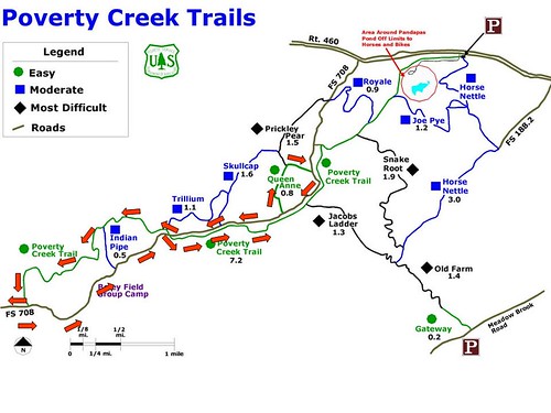
Beginner 1/Kids race- Poverty Creek, to Knobbit, turn around and come home
***What is the difference between Beginner 1 and Beginner 2? Beginner 1 is for someone who is new to mountain biking and hasn't done much at off road riding or is new to cycling. No race course is ever easy, but if you've been riding a little bit and want more of a challenge go for Beginner 2.****
XXC- course to be determined- Teresa has an idea of a really “sick” course route, but word is that it could be really , really hard, tell her(tmartinez@appalachiantrail.org) what you think: Gap to Royale to Horse Nettle, along the ridge, down beauty, along poverty creek, up horse nettle, down snake root, back on Gap. Or some twisted variation with an extra lap around queen anne, gap and royale to get back to Horse Nettle.
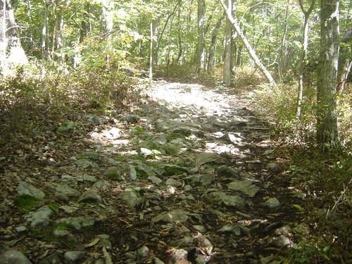
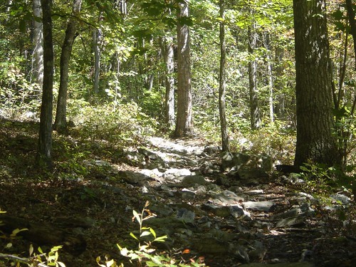
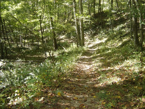
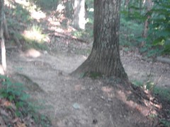
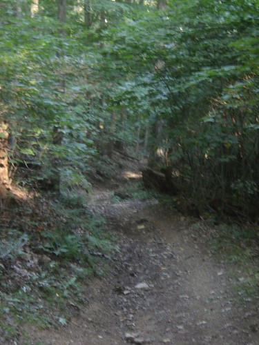
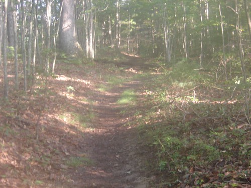
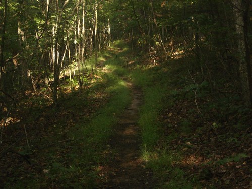
Here is a description of some of the course. The main course is a lollipop shape, where you go out single track, do a loop (experts do 2 loops: The 1st down Snakeroot, the second down Beast), and return on the same single track. It is about 90% single track and 10% gravel/dirt road.
Sport
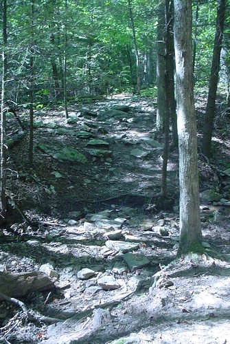
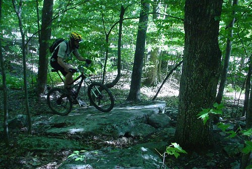
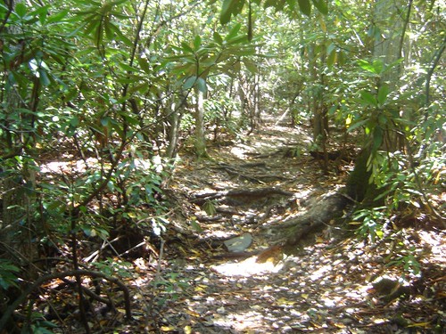
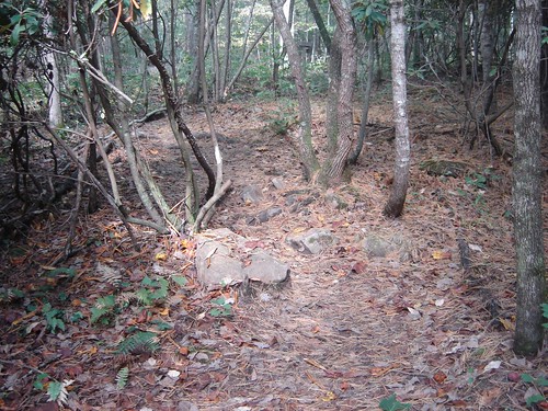
**NOTE** most of the pictures here show some techncial trail features because pictures of smooth trail all look the same. It isn't all like the pics below so don't let them scare you ****
Start
The start line will be on the FS 708. This is all gravel and will be slightly downhill to single-file turn onto the Gap mtn Side poverty creek trail. The road length is just slightly long enough to string people out, but you will be coming to an almost complete stop as riders que up to turn onto the single track. As with any mtn bike race position to the front is an advantage, but let me tell you, this is a long hard course and there is plenty of opportunity to pass. So be courteous at the que and let's get everyone through safely.
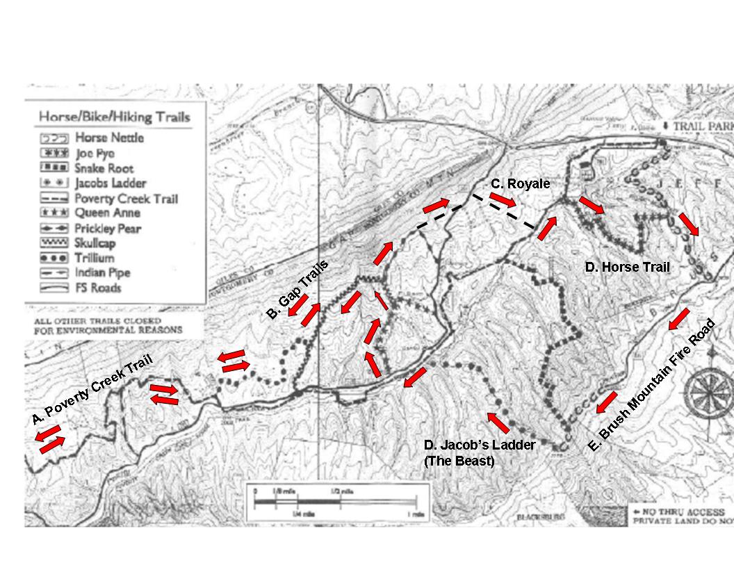
A. Gap Side Poverty Creek Trail
This was a trail that was cut several years ago by the Forrest service with a small tractor. Poverty creek is actually on the other side of the fire road, but it was constantly muddy and under water so they moved part of the trail to the Gap mountain side. When it was originally cut it was very wide, nicknamed the Interstate. Over the years the track has been worn in making it more single track but with plenty of width to pass when needed.
This portion has some short steep climbs/downhills. It is typical very dry and loose with gravel on top of hardpack as well as some deep sandy sections. Watch yourself here, as it is VERY easy to override the turns. Many of the turns are just slightly off camber and can catch you off guard especially when you are at the redline.
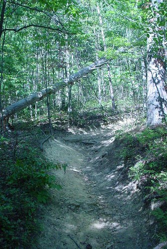
There are also several false flats. The perception is that it is flat or downhill but it is really a gradual climb. This can really play with your mind so don't worry. There are a few large logs across the trail that will require dismounts.
The trail will come to a T and you will continue up the steep hill to the left. I believe that one of the beginner courses will use the T as a turn around point.
This trail will eventually top out and dump you onto an old gravel jeep road downhill. This is a rocket run downhill but be careful of the corners. Before this road reaches FS 708 there will be a left hand turn onto the Trillium Singletrack which is part of the Gap Mountain trails.
B. Gap Mountain Trails
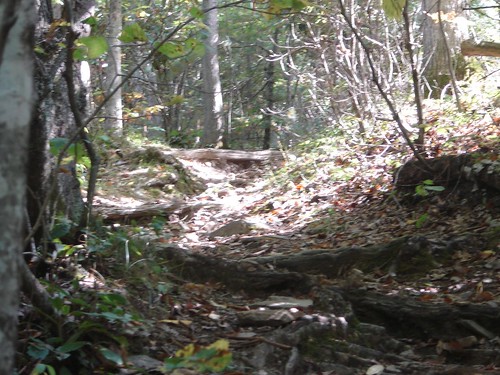
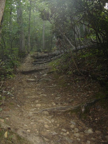
These trails are definitive of mid Atlantic single track. Rocky, rooty, twisty. Just phenomenal. This direction is the harder way with more climbing than on the way back. There are plenty of rock gardens, small stream crossings, and roots.
It's not all rocky and there is plenty of smooth fast single track too.
These trails tend to follow the countour lines so there aren't any real long climbs but there are several very steep grunter climbs, so save some energy for those.
Several rock gardens consists of those buried baby head rocks that require momentum to get through. The key is to go fast enough that you can ride across the tops and keep from getting sucked down into the crevices. So again, save some gas for these.
There are some technical rock gardens, the key is to be fluid and nimble and be able to pop the front wheel on demand. All this gets harder in a race situation though so if it seems over your head walk it, I do plenty of times.
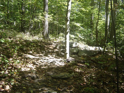
When you reach a stone bridge you are just a few yards from a 3 way intersection and the start of the loop.
At the 3 way intersection you will bear to the left. This leads you into some steep climbing with some of the toughest rock garden sections to get through. This will lead to another Y. We will go to the left onto some of the newer singletrack in the area. A very fun track. Some technical sections
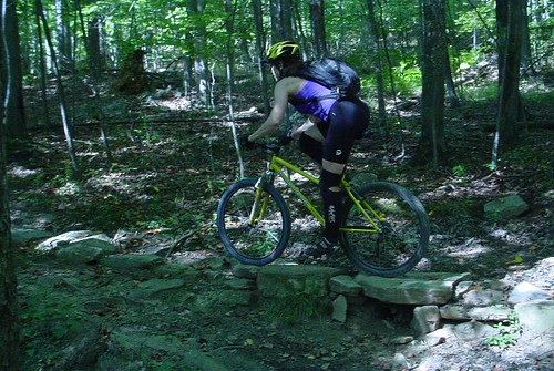
 (though we go the other direction of this rider)
C. Royale
This trail drops down to the main Forrest Service road 708 that you drove in on and started on. A short jog to the left up the road and you'll turn onto the Royale (with cheese) singletrack. This a super super fun run . The top part is fast and fairly smooth. It leads into a fast rough section that will really bounce you around. The trees are tight and there are some small logs that can be ridden across the trail. After the rough section there is a new wider cut that was done by the forrest service. It is a zig-zaggy section with some really tight and fast corners that also have NO camber. So get your weight on the outside pedal and brake before the turns, otherwise you'll slide ride off.
This dumps onto the original Poverty creek Trails. And you'll make a left
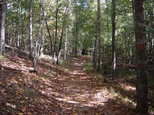
This trail is smooth and fast and mid to big ring. This is a multi use trail so be aware of hikers.
D. Horse Trails
You'll make a sharp right turn across the creek and get onto Joe Pye. AKA Horse hair. This is a really fun pretty section that has a slight incline to it but is a mid ring blast. The trail cuts through the foliage with some tunnels, and crosses a few small creaks.
Watch the wet roots. It eventually starts climbing to a midpoint where you drop all the way back down to the creek again.
This leads to the main horse trail which is the longest extended climb of the course. The trail is wide, and smooth with one really steep loose grunt. This trail tops out onto the Brush Mountain Jeep Road which runs along the top of Brush Mountain.
E. Brush Mountain Fire Road
This road has several large rollers on it. It's tough to hold your speed up and over but if you can you'll make big time though the risk is blowing up sky high. There always seems to be one more roller every time I ride it.
You'll come to a fire circle that the locals use turn burn their spare refrigerators, vehicles, and sofas. There is a new single track here that // the fire road. It is really fun but loose so watch the turns. It comes out at the top of the Snake Root Trail.
It hasn't been decided yet if the course will run down Snake Root or run down Jacob's Ladder. Historically the course has gone down Jacob's ladder aka the Beast
D. The Beast
I love the Beast. It's just an awesome run. It was called the Beast because for many years it had been very overgrown and by the time you got to the bottom your arms and face would be cut up from overhanging pricker bushes so it looked like you did battle with a Beast.
The very top is smooth with some tight switchbacks.
This leads to a straight rocket run with a sidehill to the right.
Let off the brakes and look out cause it is fast. Watch the speed though, because it trail eventually comes to a slight right turn. The mid section is some troughs through the rhododendrons and then levels out to a very fast big ring section. At a slight upgrade there is a large log across the trail so keep your head up for this.
There is some more big ring flatter stretches before it get real steep again
This eventually leads to a steep rough trough.
At the bottom there are some 2-3' drops off the roots. Sometimes you can sky off them though rolling them can be safer, IF you remember to get your weight back and NOT use the front brake.
At the very bottom is a root stair case
GET YOUR WEIGHT BACK and STAY OFF THE FRONT BRAKE. Walk it if necessary. Don't cut to the right too far or your handlebar will get caught by the small trees that line the side.
At the bottom wring out your hands from all the braking and jump back onto the Poverty Creek through this small rock garden
Turn Left on the creek trail. Smooth Big Ring blast.
This will dump you out to a parking area where there should be a water station. A sharp right and you'll cross that same FS 708 gravel road and will climb onto the Queene Ann (Old Gap) trail. This rolls on some short steep ups and downs. Be careful of the small woodenbridge if it is wet. It gradually climbs to eventually connects at that 3 way intersection where the loop started.
In years past experts turned right and did another loop, and sports turned left and went back the way they came to the finish. It hasn't been decided if there will be an additional loop for experts or not.
The way back is slightly easier than the way out except for the fact that you've got a lot of hard riding under your belt. The gravel road climb is also an oven if it is hot. The last section can also catch you by surprise as there are several steep grunters and off camber turns. By this time you're pretty wasted but you still have to be vigilant.
Summary
This is a hard course no doubt about it. No recovery. you are either climbing, or downhilling in technical terrain. Be prepared with food and water. It can get really hot in the open sections. The rocks claim many flat tires, so make sure you know what tire pressure works for you.
Just for reference, I am an upper level vet sport / low level vet ex racer. Last week I did a race simulation and had the following splits
Start to 3way : 37
Loop: 55
3 way back to the finish 36
I run IRC Serac 2.1s up front and IRC Mythos 2.1 in the rear with Stan's Tubeless at 28psi (I'm 130lbs). The course is perfectly doable on a hardtail and might even be faster given the climbing, but there is a lot of trail chatter that makes a full suspension very nice on the long haul.
So anyway, please come out if you're interested. It's a really awesome challenging course and it will be a low key grass roots hanging out kind of time.
Special Thanks to Teresa Martinez for taking on the thankless job of promoting this race and Nancy for coordinating volunteers. There is so much work that goes on behind the scenes to pull something like this off, even a low key grassroots version. And please thank the volunteers/SAR/ ham radio guys if you come out to race, things like these can't happen w/o them.
thanks
posted by Ashwin Amanna @ 8:16 AM
2 comments
![]()


2 Comments:
This race has always been a favorite of mine. Great terrain and organized very well. I highly recommend it.
Where's the MWC FTJ NGT route?
Post a Comment
<< Home